Due to the typhoon’s impact, the central and eastern parts of Taiwan are expected to see heavy rainstorms from Wednesday morning until Thursday morning…reports Asian Lite News
China’s flood control authorities have activated a level-4 emergency response against Koinu, the 14th typhoon of this year, so as to better cope with gales and rainstorms expected to hit the country’s southeastern regions on Wednesday.
In a forecast early Wednesday, the National Meteorological Centre said that Koinu had weakened in intensity from a super typhoon to a severe typhoon as of Tuesday night, reports Xinhua news agency.
The weather bureau has also maintained a yellow alert against the typhoon, observed at 22.0 degrees north latitude and 124.0 degrees east longitude at 5 a.m. on Wednesday, is expected to travel northwestward at a speed of 10 to 15 km per hour and gradually move closer to the southern coastal areas of Taiwan, the Centre said.
Due to the typhoon’s impact, the central and eastern parts of Taiwan are expected to see heavy rainstorms from Wednesday morning until Thursday morning, it said.
Meanwhile, gales are forecast to sweep parts of the East China Sea and South China Sea, as well as the coastal areas of Zhejiang and Fujian provinces in from Wednesday morning until Thursday morning, it said.
The State Flood Control and Drought Relief Headquarters, which issued the emergency response, have emphasized the need to strengthen forecasts and make early warnings so that offshore vessels and fishing personnel and those on offshore operation platforms could take shelter timely and stay safe.
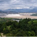
The headquarters decided to maintain level-4 responses in dealing with the flood control work in Hubei, Shaanxi, Chongqing and Sichuan.
Heavy rains, winds in Taiwan
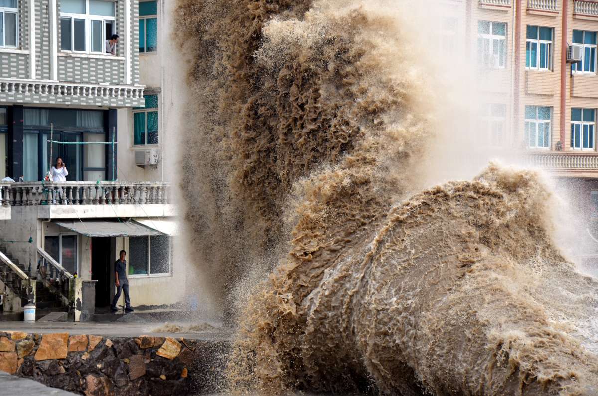
Typhoon Koinu on Wednesday pounded Taiwan with heavy rain and winds. This led to the closure of businesses and schools in the east and triggered warnings in most parts of the island a day before its expected landfall, forecasters said, The New York Times reported.
The island’s Central Weather Administration said that Koinu, which formed over the Pacific Ocean last weekend, was about 105 miles east of Taiwan on Wednesday afternoon.
It was moving west at about 9 miles per hour, carrying maximum sustained winds of 132 m.p.h. and even stronger gusts, according to the Joint Typhoon Warning Center, a meteorological service operated by the US Navy.
The storm is expected to make landfall on Taiwan’s southeastern coast on Thursday morning, and the island will see the heaviest rainfall on Thursday and Friday, Wu Wan-hua, a meteorologist for Taiwan’s weather agency, said at a news conference. Wave heights of more than seven meters, or 23 feet, are expected around the coasts of southern Taiwan, she added.
Koinu’s winds were equivalent to those of a Category 4 hurricane on Wednesday morning, but were expected to weaken to Category 3 levels before landfall, the Joint Typhoon Warning Center said. After crossing the southern tip of Taiwan, the storm is likely to weaken into a tropical storm, then graze China’s southeastern coast later in the week, approaching Hong Kong, as per The New York Times.
The storm’s effects were also being felt in parts of the northern Philippines. Officials in that country have issued wind and rain advisories, warning that landslides were possible in mountainous areas.