The UN backs an African Union campaign to promote more accurate world maps, challenging longstanding distortions in the representation of Africa and other regions, reports Asian Lite News Desk
The United Nations General Assembly has overwhelmingly backed an African Union-led initiative calling for more accurate and equitable representations of the world on maps, with particular emphasis on Africa.
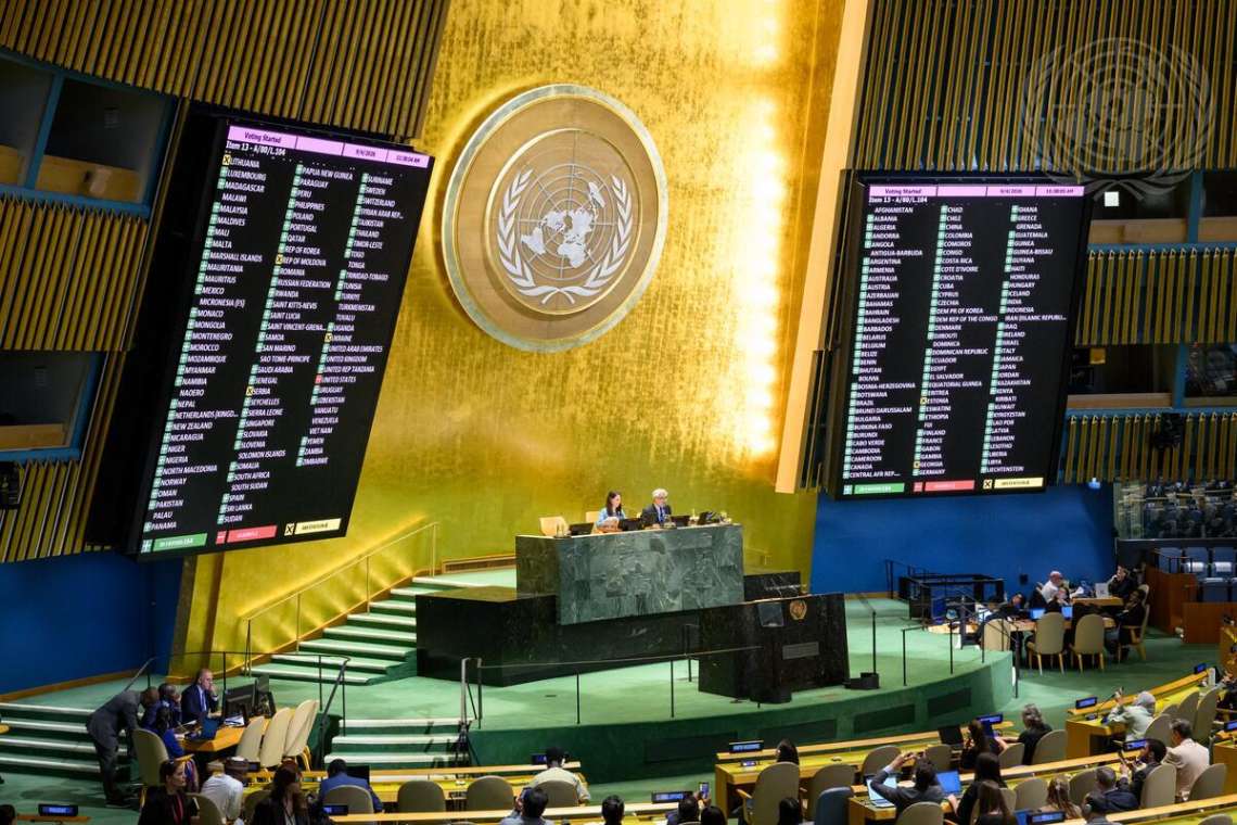
The resolution, titled “Correct the Map” and sponsored by Togo on behalf of the African Group, was adopted with 164 countries voting in favour. One country voted against the measure, while six abstained.
The African Union welcomed the decision, describing it as an important step towards ensuring that maps more accurately reflect the actual geographical size of Africa and other regions.
AU Commission Chairperson Mahmoud Ali Youssouf praised Togo for leading the initiative and commended African countries for maintaining a united position in securing broad international support for the resolution.
“The adoption of this resolution marks an important step forward,” Youssouf said, congratulating Togo and President Faure Essozimna Gnassingbé for championing the initiative.
The campaign focuses on the widespread use of the Mercator projection, a 16th-century mapping system developed primarily for navigation. While the projection remains useful for navigational purposes, it does not preserve the relative area of land masses and can make regions closer to the poles appear substantially larger than they are.
The African Union argues that this has contributed to a distorted visual understanding of Africa’s geographical scale. It has therefore called for greater use of equal-area projections, including the Equal Earth projection, in classrooms, media, international institutions and other public-facing settings.
The AU Commission said the initiative is about more than cartography, arguing that Africa should be represented according to “objective and scientifically established realities”.
The bloc also urged international organisations, educational institutions, publishers and digital platforms to progressively adopt maps that provide a more accurate comparison of the size of continents and countries.
The African Union’s Permanent Observer Mission to the UN described the General Assembly vote as an important advance for the initiative, congratulating Togo and the African Group on the adoption of resolution A/80/L.104.
The AU Commission said it would continue working with Togo, its member states and other partners to support implementation of the initiative.
Youssouf said the campaign was ultimately about ensuring that Africa is depicted according to its actual dimensions and its place in the international community.
“Africa must be represented as it truly is: in its true dimensions and in its rightful place in the world,” he said.
The UN vote provides broad international backing for efforts to encourage greater use of equal-area maps, while recognising that the Mercator projection continues to have practical value, particularly for navigation.
Mercator projection
The initiative centres on a problem that has been familiar to cartographers for centuries: it is impossible to transfer the surface of a spherical Earth onto a flat sheet without introducing some form of distortion.
The map projection most commonly associated with this problem is the Mercator projection, created by Flemish cartographer Gerardus Mercator in 1569. It was designed primarily as a navigational tool because of its ability to represent directions in a particularly useful way for sailors.
Its strength for navigation, however, comes with a major geographical compromise.
The Mercator projection progressively enlarges areas as they move away from the Equator towards the poles. Consequently, countries and territories in northern and southern high latitudes can appear considerably larger than their actual land area.
That distortion is particularly striking when Greenland is compared with Africa. On many Mercator-based maps, Greenland can appear comparable in size to Africa or other enormous land masses. In reality, Africa is about 14 times larger than Greenland.
The distortion is not the result of Africa itself being deliberately reduced on the map. Rather, it is a consequence of the mathematical method used to flatten the globe. Because Africa extends across relatively low and middle latitudes, it receives far less of the enlargement that affects territories closer to the poles.
The effect can also be seen elsewhere. Brazil, for example, is often visually understated compared with northern countries on conventional world maps, despite being larger than the contiguous United States. Alaska can likewise appear enormous on Mercator maps even though its actual area is smaller than that of Libya.
National Geographic has noted that the Mercator projection distorts the relative size of continents, particularly near the poles, and can shape people’s mental understanding of the world’s geography.
Why the Mercator map became so influential
The Mercator projection was never intended to provide a perfectly accurate picture of the relative size of continents.
Its principal advantage was navigation.
On a Mercator chart, a line representing a constant compass bearing, known as a rhumb line, can be drawn as a straight line. This made the projection highly practical during the age of maritime exploration, when sailors needed charts that could help them maintain a particular direction over long distances.
That practical advantage helped the projection become enormously influential. It was subsequently reproduced in atlases, classrooms, newspapers and other educational material, making it one of the most recognisable ways of depicting the planet.
But the projection’s usefulness for navigation should not be confused with accuracy in representing area.
No flat map can simultaneously preserve every characteristic of the Earth perfectly. Depending on the projection, cartographers must make choices about what to preserve, including shape, distance, direction or area.
An equal-area projection, by contrast, is designed to preserve the relative size of land masses. Shapes may look different from those on a Mercator map, but the areas are represented proportionately.
That distinction is at the heart of the African Union’s campaign.
Is the Mercator projection actually ‘wrong’?
Not necessarily.
That is an important distinction in the debate.
The Mercator projection is not a mistake that can simply be corrected by replacing it with another map. Every projection involves compromises because the Earth is three-dimensional and approximately spherical, while a conventional map is two-dimensional.
The Mercator projection’s distortion of area is a known mathematical property rather than an error in its construction.
Its particular value is that it preserves local angles and directions, making it especially useful for navigation. For that reason, Mercator-derived charts continue to have important practical applications.
The problem arises when a projection created for a specific technical purpose is treated as though it were an accurate representation of the relative size of the world’s land masses.
A map designed to help a sailor navigate is answering a different question from a map designed to teach children how large Africa, Europe, Asia or Greenland actually are.
This is why cartographers use different projections for different purposes.
What would change under an equal-area map?
Under an equal-area projection, Africa would appear much closer to its true proportion relative to other continents and countries.
Greenland would shrink dramatically compared with its appearance on a Mercator map, while areas near the Equator would occupy a proportionally larger share of the map.
The change can be visually surprising because generations of people have become accustomed to the appearance of the Mercator world.
The issue also illustrates why maps can influence perceptions even when the underlying geographical facts remain unchanged.
A country does not become larger or smaller because of the projection used to draw it. But the visual impression created by the map can affect how people understand geographical scale.
The African Union’s campaign therefore seeks greater awareness of those limitations and greater use of projections that preserve area when the purpose is to communicate geographical size.
A wider debate about how the world is portrayed
The debate over world maps is not new.
Cartographers have developed hundreds of projections because no single flat representation can perfectly preserve every property of the globe.
The Peters projection, for example, gained attention because it preserves relative area, although its shapes can appear substantially different from those familiar from Mercator maps.
The Equal Earth projection, promoted by the African Union in its current campaign, is another approach that combines equal-area properties with a visually balanced presentation.
The choice of projection can therefore reflect the purpose of a map.
A navigation chart may prioritise direction. A statistical map may prioritise area. A map showing travel distances may prioritise distance. A classroom map may seek a balance between recognisable shapes and accurate relative areas.
The African Union’s campaign is effectively asking institutions to become more conscious of that distinction.