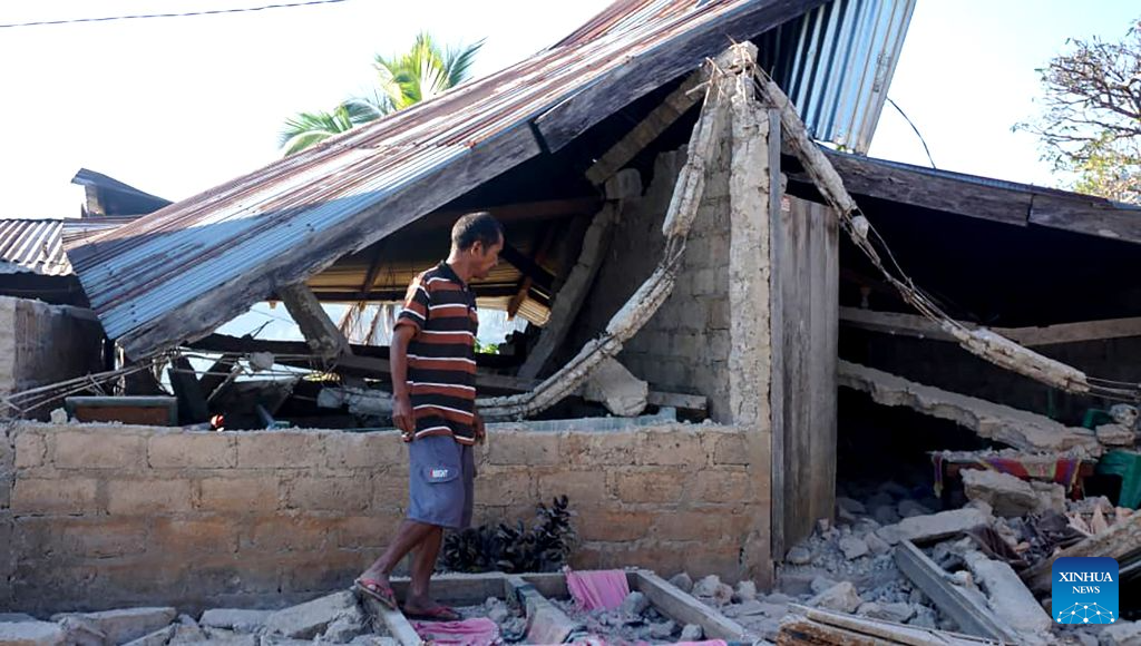
The death toll from a 7.7-magnitude earthquake off Indonesia’s Flores Island has risen to 47, with hundreds of homes and public facilities damaged…reports Asian Lite News Desk
The death toll from a 7.7-magnitude earthquake and several strong aftershocks that struck off the coast of Flores Island in eastern Indonesia has risen to 47, the country’s National Disaster Mitigation Agency (BNPB) said on Saturday.
The BNPB said in its latest update that at least 346 houses had been damaged. Of these, 157 were severely damaged, 41 sustained moderate damage and 148 suffered minor damage.
The earthquake also damaged public infrastructure across the affected areas, including 87 educational facilities, 18 health facilities, five places of worship and six government offices, according to the agency.

Melki Laka Lena, governor of East Nusa Tenggara province, said some roads had been cut off or blocked by landslides following the earthquake.
Speaking at a press conference in Kupang on Saturday, Laka Lena said authorities were continuing to assess the situation and address disruptions caused by the disaster, Xinhua News Agency reported.
The BNPB has begun sending food and other relief supplies to affected communities. Supplies have been dispatched from a logistics warehouse in East Flores Regency, while additional relief material is being transported from Jakarta through Halim Perdanakusuma Air Force Base.
Several flights in East Nusa Tenggara province were also cancelled following the earthquake, adding to transport difficulties in the affected region.
The earthquake was centred near Mbay town in Nagekeo Regency and struck early Saturday. The tremor prompted a tsunami warning, which was subsequently lifted by Indonesia’s Meteorology, Climatology and Geophysics Agency (BMKG).
Rescue and emergency teams are continuing to assess casualties and damage in areas affected by the earthquake and aftershocks.
The disaster was followed by another strong earthquake elsewhere in Indonesia on the same day. A 6.4-magnitude earthquake struck North Sumatra province on Saturday, according to the BMKG.

The second earthquake occurred at 5:54 pm local time, with its epicentre located on land about 11 km southeast of Simalungun at a depth of 163 km, the agency said.
The tremor was felt in several parts of North Sumatra, but the BMKG said it had no tsunami potential.
There were no immediate reports of casualties or damage from the North Sumatra earthquake.
Indonesia is located on the Pacific Ring of Fire, a region characterised by frequent seismic and volcanic activity. Authorities regularly monitor earthquakes across the archipelago because of the potential for strong tremors and associated hazards.
For now, emergency operations remain focused on the Flores region, where authorities are working to locate affected residents, assess structural damage and deliver essential supplies.